Kansas aquifer water levels plunge
KU scientists identify drought impact across much of the state.
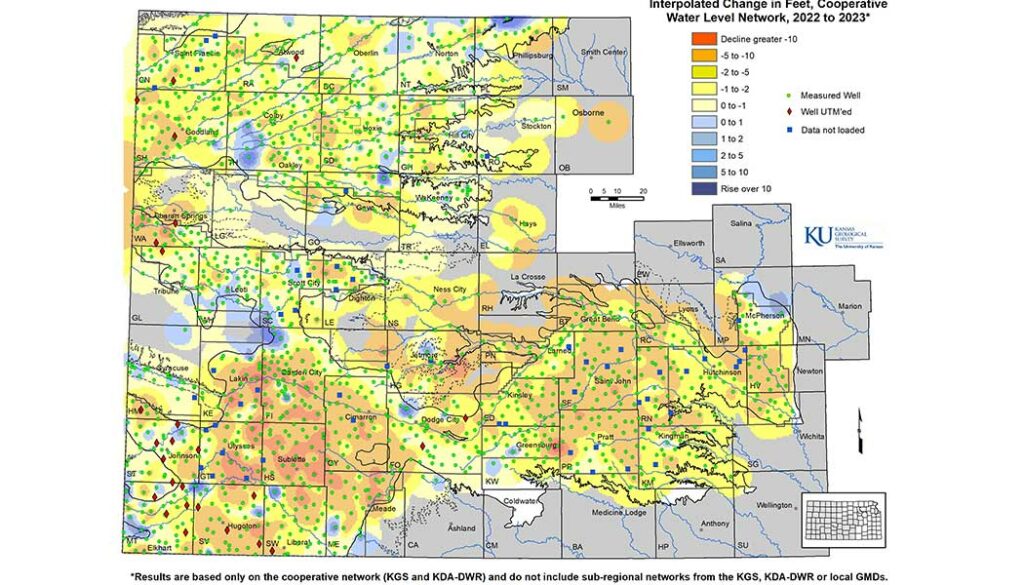
Average groundwater levels across western and south-central Kansas fell by nearly 2 feet in 2022, according to preliminary data compiled by the Kansas Geological Survey.
The KGS, based at KU, and the Division of Water Resources (DWR) of the Kansas Department of Agriculture measure about 1,400 wells every year to monitor the health of the High Plains aquifer and other aquifers in western and south-central Kansas. Those measurements showed an overall average decline of 1.89 feet last year.
KGS is so vital to the state that this year the Kansas Legislature designated funding increases for KGS research and salaries in the fiscal year 2024 budget.
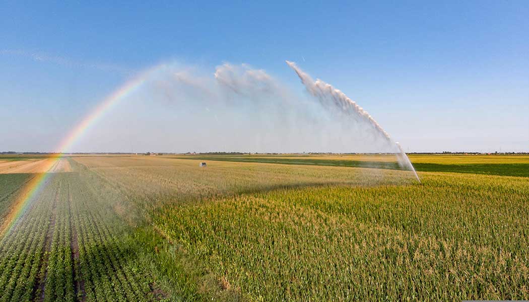
Most parts of the region saw well-below-average precipitation throughout the year. Some areas in Kansas were the driest ever based on historical records, some of which go back to the late 1800s. Dry years lead to increased pumping demands, primarily for irrigation, which in turn typically cause greater declines in water levels.
“We anticipated and saw declines pretty much across the aquifer,” says Brownie Wilson, KGS water data manager. “Because of the ongoing drought, the pumping season lasted a little longer this past year, and there were a notable number of wells pumping in January and February. As such, some of the measured declines will likely be slightly excessive given the aquifer didn’t have its normal time to recover.”
“We anticipated and saw declines pretty much across the aquifer,” says Brownie Wilson, KGS water data manager. “Because of the ongoing drought, the pumping season lasted a little longer this past year, and there were a notable number of wells pumping in January and February. As such, some of the measured declines will likely be slightly excessive given the aquifer didn’t have its normal time to recover.”
The overall average decline of 1.89 feet in 2022 is the third largest in 25 years, on par with notable dry years of 2011 (when water levels fell 1.93 feet) and 2012 (a decline of 2.01 feet). It also marks the third straight year of overall declines.
At the end of 2022, all 105 counties in Kansas were under a drought watch, warning or emergency status. As of the end of February, the western and southern parts of the state covered by the groundwater monitoring program were experiencing severe to exceptional drought, according to U.S. Drought Monitor maps produced by the National Drought Mitigation Center at the University of Nebraska-Lincoln, the U.S. Department of Agriculture and the National Oceanic and Atmospheric Administration.
The High Plains aquifer is a network of water-bearing rock that extends into eight states. In Kansas, the aquifer comprises three components: the Ogallala aquifer, the Great Bend Prairie aquifer and the Equus Beds. Of these, the Ogallala aquifer underlies most of western Kansas and consists mainly of the Ogallala Formation, a geologic unit that formed from sediment eroded off the uplifting Rocky Mountains.
Most of the wells in the network monitored by the KGS and DWR are within the boundaries of the state’s five Groundwater Management Districts (GMDs), which are organized and governed by area landowners and local water users to address water resource issues.
In Southwest Kansas GMD 3, average groundwater levels dropped 2.77 feet in 2022, following declines of 2.08 feet in 2021 and 1.25 feet in 2020. The region experienced the most severe drought conditions in the state in 2022, with widespread areas receiving 50% to 75% of long-term precipitation averages.
“Precipitation, or the lack thereof, is just one variable that goes into water level changes,” Wilson says. “Soil types, evaporation, water availability and a variety of aquifer conditions are all key factors in how water is used across our state. Southwest Kansas tends to have higher rates of decline but also has some of the greatest thicknesses in the aquifer.”
Aquifer thickness is the vertical amount of aquifer that is saturated with water and is an indicator of how much water is in storage.
In contrast to the overall long-term declines observed in western Kansas GMDs, increases and decreases in water levels in Great Bend GMD 5 and Equus Beds GMD 2 in the south-central part of the state tend to even out over time. Last year, however, both districts saw larger than normal decline rates.
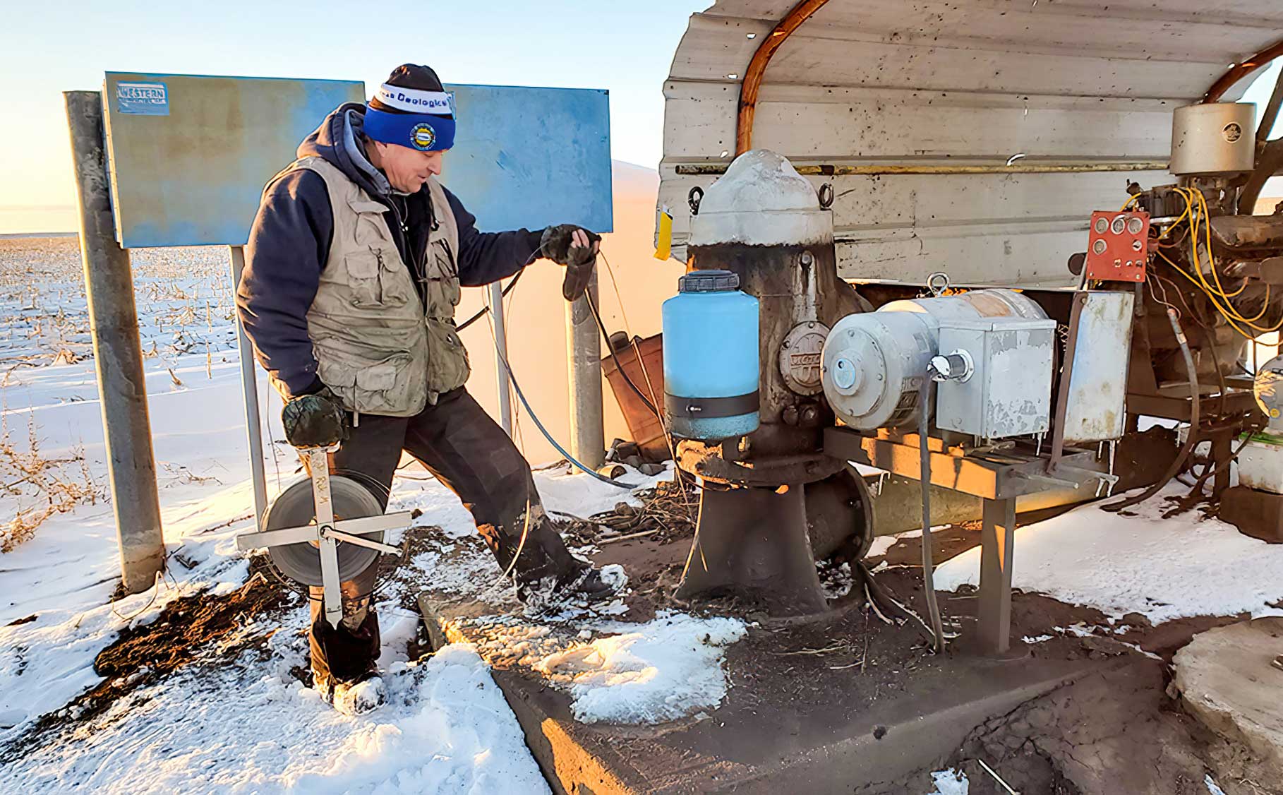
The KGS measured 615 wells in western Kansas, and DWR staff from field offices in Stockton, Garden City and Stafford measured 221, 263 and 350 wells, respectively, in western and south-central Kansas. Most of the wells, spread over 49 counties, are used for irrigation and have been measured for decades with landowners’ permission.
Measurements are taken primarily in January, when water levels are least likely to fluctuate from seasonal irrigation. The measurement results, available on the KGS Water Well Levels Database, are provisional and subject to revision based on additional analysis.
KGS is a KU research and service division that studies and provides information
about the state’s geologic resources and hazards.
/